Geolocate

Conner Lake topographic map

Click on the map to display elevation.

About this map

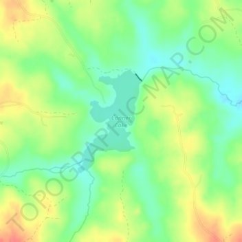
Name: Conner Lake topographic map, elevation, terrain.

Location: Conner Lake, Halifax County, Virginia, United States (36.91451 -78.80694 36.92608 -78.79800)

Average elevation: 427 ft

Minimum elevation: 341 ft

Maximum elevation: 535 ft

Halifax County trails, hiking, mountain biking, running and outdoor activities

Other topographic maps

Click on a map to view its topography, its elevation and its terrain.

McKendree

United States > Virginia > Halifax County

Average elevation: 495 ft

Nathalie

United States > Virginia > Halifax County

Average elevation: 502 ft

Sutherlin

United States > Virginia > Halifax County

Average elevation: 466 ft

Jones

United States > Virginia > Halifax County

Average elevation: 489 ft

Liberty

United States > Virginia > Halifax County

Average elevation: 535 ft

Gear up for your next adventure:

🛌Ultralight Sleeping Bags - Compact down bags for cold nights in the wilderness
🧭Orienteering Set - Complete compass and map reading kit
🪵Folding Camp Saw - Compact saw for wood and campsite work
🏕️Family Camping Gear - Essentials for group camping trips
📡Handheld GPS Device - Reliable handheld GPS for outdoor navigation

As an Amazon Associate, this site earns from qualifying purchases at no extra cost to you.