
Thank you for supporting this site ❤️
Make a donation
Make a donation
Gear up for your next adventure:
As an Amazon Associate, this site earns from qualifying purchases at no extra cost to you.
Stalwart topographic map
Click on the map to display elevation.
Thank you for supporting this site ❤️
Make a donation
Make a donation
Gear up for your next adventure:
As an Amazon Associate, this site earns from qualifying purchases at no extra cost to you.
About this map
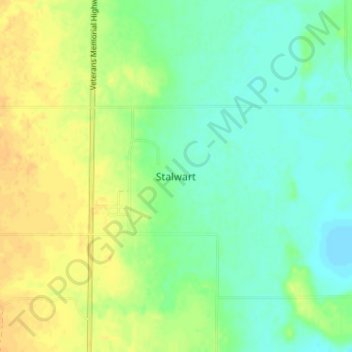
Name: Stalwart topographic map, elevation, terrain.
Location: Stalwart, Big Arm No. 251, Saskatchewan, Canada (51.21333 -105.45333 51.25333 -105.41333)
Average elevation: 1,650 ft
Minimum elevation: 1,611 ft
Maximum elevation: 1,696 ft
Thank you for supporting this site ❤️
Make a donation
Make a donation
Gear up for your next adventure:
As an Amazon Associate, this site earns from qualifying purchases at no extra cost to you.