
Pantaleón Dalence topographic map
Interactive map
Click on the map to display elevation.
About this map
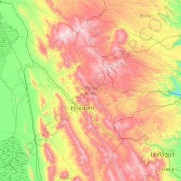
Name: Pantaleón Dalence topographic map, elevation, terrain.
Location: Pantaleón Dalence, Oruro, Bolivien (-18.43328 -67.09101 -18.03749 -66.52826)
Average elevation: 13,376 ft
Minimum elevation: 11,401 ft
Maximum elevation: 15,850 ft
Other topographic maps
Click on a map to view its topography, its elevation and its terrain.