
Oruro topographic map
Interactive map
Click on the map to display elevation.
About this map
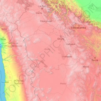
Name: Oruro topographic map, elevation, terrain.
Location: Oruro, Bolivien (-21.26667 -70.26667 -16.06667 -65.06667)
Average elevation: 10,545 ft
Minimum elevation: 0 ft
Maximum elevation: 20,850 ft
Other topographic maps
Click on a map to view its topography, its elevation and its terrain.