Geolocate

Astu topographic map

Click on the map to display elevation.

About this map

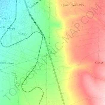
Name: Astu topographic map, elevation, terrain.

Location: Astu, Hells Gate ward, Naivasha, Nakuru, Rift Valley, Kenya (-0.81980 36.44428 -0.77980 36.48428)

Average elevation: 6,749 ft

Minimum elevation: 6,421 ft

Maximum elevation: 7,106 ft

Gear up for your next adventure:

Backpacking Tents - Weight-optimized shelters for multi-day topographic surveys
🧭GPS Watch Accessories - Bands and chargers for GPS watches
🧥Waterproof Jacket for Hiking - Breathable and rugged rain jacket for outdoor excursions
🧦Hiking Socks - Comfortable socks to prevent blisters on long hikes
🔌Solar Panel Charger - Charge gear sustainably outdoors

As an Amazon Associate, this site earns from qualifying purchases at no extra cost to you.