
Thank you for supporting this site ❤️
Make a donation
Make a donation
Gear up for your next adventure:
As an Amazon Associate, this site earns from qualifying purchases at no extra cost to you.
Kirchseeon topographic map
Click on the map to display elevation.
Thank you for supporting this site ❤️
Make a donation
Make a donation
Gear up for your next adventure:
As an Amazon Associate, this site earns from qualifying purchases at no extra cost to you.
About this map
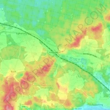
Name: Kirchseeon topographic map, elevation, terrain.
Location: Kirchseeon, Landkreis Ebersberg, Bavaria, 85614, Germany (48.04632 11.83404 48.09283 11.92967)
Average elevation: 1,883 ft
Minimum elevation: 1,732 ft
Maximum elevation: 2,087 ft
Thank you for supporting this site ❤️
Make a donation
Make a donation
Gear up for your next adventure:
As an Amazon Associate, this site earns from qualifying purchases at no extra cost to you.