Geolocate

Bresso topographic map

Click on the map to display elevation.

About this map

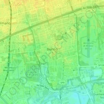
Name: Bresso topographic map, elevation, terrain.

Location: Bresso, Zona Omogenea Milano Nord, Milan, Lombardy, 20091, Italy (45.52686 9.17907 45.54616 9.21038)

Average elevation: 482 ft

Minimum elevation: 440 ft

Maximum elevation: 515 ft

Other topographic maps

Click on a map to view its topography, its elevation and its terrain.

Monte Stella

Italy > Lombardy > Milan > Milan

Average elevation: 440 ft

Fagnano

Italy > Lombardy > Milan > San Vito

Average elevation: 394 ft

Castelletto di Cuggiono

Italy > Lombardy > Milan

Average elevation: 466 ft

Zivido

Italy > Lombardy > Milan > San Giuliano Milanese

Average elevation: 308 ft

Mazzo

Italy > Lombardy > Milan > Rho

Average elevation: 509 ft

Ospiate

Italy > Lombardy > Milan > Bollate

Average elevation: 512 ft

Mariotto

Italy > Lombardy > Milan > San Colombano al Lambro

Average elevation: 203 ft

Pantanedo

Italy > Lombardy > Milan > Rho > Mazzo

Average elevation: 502 ft

Cascina Confaloniera

Italy > Lombardy > Milan > Rosate

Average elevation: 351 ft

San Pietro all'Olmo

Italy > Lombardy > Milan > Cornaredo

Average elevation: 466 ft

Gear up for your next adventure:

💧Water Filtration Bottles - Safely drink from streams and lakes while exploring
🧥Waterproof Jacket for Hiking - Breathable and rugged rain jacket for outdoor excursions
📦Gear Storage Bags - Organize and protect outdoor equipment
🧷Carabiner Set - Durable clips for gear attachment
🪶LED Camping Lantern - Bright lantern for camp lighting

As an Amazon Associate, this site earns from qualifying purchases at no extra cost to you.