Geolocate

朱衣镇 topographic map

Interactive map

Click on the map to display elevation.

About this map

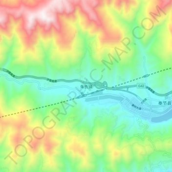
Name: 朱衣镇 topographic map, elevation, terrain.

Location: 朱衣镇, 奉节县, 渝东北三峡库区城镇群区位, 重庆市, 中国 (30.99090 109.32300 31.07090 109.40300)

Average elevation: 1,962 ft

Minimum elevation: 472 ft

Maximum elevation: 4,501 ft

Other topographic maps

Click on a map to view its topography, its elevation and its terrain.

瞿塘峽

中国 > 重庆市 > 奉节县 > 白帝镇

瞿塘峽, 三峡之巅徒步道, 白帝镇, 奉节县, 渝东北三峡库区城镇群, 重庆市, 中国

Average elevation: 1,627 ft

白帝城

中国 > 重庆市 > 奉节县 > 白帝

白帝城, 白帝, 奉节县, 渝东北三峡库区城镇群, 重庆市, 中国

Average elevation: 804 ft

白帝镇

中国 > 重庆市 > 奉节县

白帝镇, 奉节县, 渝东北三峡库区城镇群, 重庆市, 中国

Average elevation: 1,430 ft

五马镇

中国 > 重庆市 > 奉节县

五马镇, 奉节县, 渝东北三峡库区城镇群区位, 重庆市, 中国

Average elevation: 2,799 ft

奉节县

中国 > 重庆市 > 奉节县

奉节县, 渝东北三峡库区城镇群, 重庆市, 中国

Average elevation: 2,146 ft