Geolocate

Rovinj topographic map

Click on the map to display elevation.

About this map

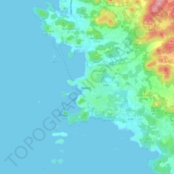
Name: Rovinj topographic map, elevation, terrain.

Location: Rovinj, Grad Rovinj, Istria County, 52210, Croatia (45.04074 13.60173 45.12074 13.68173)

Average elevation: 62 ft

Minimum elevation: -3 ft

Maximum elevation: 466 ft

Gear up for your next adventure:

🪑Ultralight Camp Chairs - Portable seating for resting after a long day of mapping
🧢Outdoor Hiking Hat - Sun protection hat for outdoor explorers
🔋Solar Power Banks - Keep your GPS and phone charged in remote wilderness areas
🔭Telescopic Hiking Pole - Adjustable pole for hiking stability
🗃️Trail First Aid Kit - Essential kit for outdoor injuries and emergencies

As an Amazon Associate, this site earns from qualifying purchases at no extra cost to you.