Geolocate

Fackler topographic map

Click on the map to display elevation.

About this map

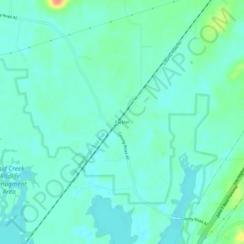
Name: Fackler topographic map, elevation, terrain.

Location: Fackler, Jackson County, Alabama, United States (34.77258 -85.92998 34.81258 -85.88998)

Average elevation: 617 ft

Minimum elevation: 581 ft

Maximum elevation: 738 ft

Jackson County trails, hiking, mountain biking, running and outdoor activities

Other topographic maps

Click on a map to view its topography, its elevation and its terrain.

Langston

United States > Alabama > Jackson County

Average elevation: 797 ft

Paint Rock

United States > Alabama > Jackson County

Average elevation: 810 ft

Pleasant Groves

United States > Alabama > Jackson County

Average elevation: 1,086 ft

Skyline

United States > Alabama > Jackson County

Average elevation: 1,276 ft

Hytop

United States > Alabama > Jackson County

Average elevation: 1,355 ft

Dutton

United States > Alabama > Jackson County

Average elevation: 1,345 ft

Scottsboro

United States > Alabama > Jackson County

Average elevation: 771 ft

Stevenson

United States > Alabama > Jackson County

Average elevation: 810 ft

Paint Rock

United States > Alabama > Jackson County

Average elevation: 817 ft

Pisgah

United States > Alabama > Jackson County > Pisgah

Average elevation: 1,375 ft

Gear up for your next adventure:

🥩Freeze-Dried Meals - Nutritious and lightweight food for remote expeditions
🌧️Backpack Rain Cover - Keep gear dry in wet weather
Solar GPS Watches - Advanced multisport watches with built-in topographic maps
🪑Ultralight Camp Chairs - Portable seating for resting after a long day of mapping
⛑️Personal Locator Beacon - Safety beacon for emergencies

As an Amazon Associate, this site earns from qualifying purchases at no extra cost to you.