Geolocate

Hohenfels topographic map

Click on the map to display elevation.

About this map

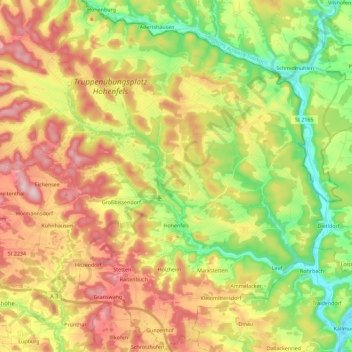
Name: Hohenfels topographic map, elevation, terrain.

Location: Hohenfels, Landkreis Neumarkt in der Oberpfalz, Bavaria, 92366, Germany (49.15097 11.76805 49.29875 11.94256)

Average elevation: 1,532 ft

Minimum elevation: 1,109 ft

Maximum elevation: 2,018 ft

Other topographic maps

Click on a map to view its topography, its elevation and its terrain.

Gear up for your next adventure:

📱Heavy-Duty Phone Cases - Drop-proof and waterproof protection for outdoor navigation
🔥Camping Stove - Portable stove for camping and backcountry cooking
👟Trail Running Shoes - Lightweight shoes for trail runners
🗻Climbing Gear Basics - Essential gear for beginner climbers
🚁Photography Drones - Capture stunning aerial views of landforms and topography

As an Amazon Associate, this site earns from qualifying purchases at no extra cost to you.