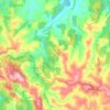
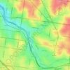
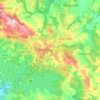
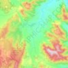
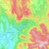
Redbank topographic map
Click on the map to display elevation.
About this map

Name: Redbank topographic map, elevation, terrain.
Location: Redbank, Victoria, Australia (-36.95888 143.30816 -36.91888 143.34816)
Average elevation: 981 ft
Minimum elevation: 801 ft
Maximum elevation: 1,631 ft
Other topographic maps
Click on a map to view its topography, its elevation and its terrain.
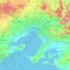
City of Melbourne
Melbourne's topography is characterized by a diverse landscape that transitions from flat coastal plains to rolling hills and mountainous regions. The city is situated at the northern end of Port Phillip Bay, where the terrain is predominantly flat, facilitating urban development. As one moves eastward, the…
Average elevation: 59 ft
Melbourne
Melbourne is also prone to isolated convective showers forming when a cold pool crosses the state, especially if there is considerable daytime heating. These showers are often heavy and can include hail, squalls, and significant drops in temperature, but they often pass through very quickly with a rapid…
Average elevation: 607 ft

















Maryborough
Maryborough enjoys a temperate climate with four distinct seasons and is typically dry and mild. The mean minimum January temperature 12.9 °C (55.2 °F) with the maximum a balmy 28.8 °C (83.8 °F), however temperatures above 35 °C (95 °F) are commonly recorded during the summer months. The highest…
Average elevation: 781 ft




Mount Beauty
The town has a prominent winter rainfall peak, with a yearly average of 1,264.6 millimetres (49.79 in). It rains on 142 days of the year; heavily concentrated between May and October. On account of its southern latitude nearing the 37th parallel, summers have a notable chill about them when compared to…
Average elevation: 2,900 ft






Bairnsdale
A comprehensive geological survey of Victoria's Great Dividing Range reveals a distinct north-south alignment in its bedrock, a vestige of the bygone epochs of plate tectonics. This enduring geological framework, coupled with ongoing tectonic activity, contributes to the dynamic topography witnessed in the…
Average elevation: 82 ft
Port Phillip
Port Phillip's mostly flat topography and moderate waves make perfect conditions for recreational swimming, kitesurfing, windsurfing, sailing, boating, snorkeling, scuba diving, stand up paddle boarding (SUP) and other sports.
Average elevation: 59 ft









Collingwood
Collingwood's topography is mostly flat, but a prominent slope extends from Hoddle Street up to Smith Street, and also along sections of Hoddle Street.
Average elevation: 98 ft