Geolocate

Pudur topographic map

Click on the map to display elevation.

About this map

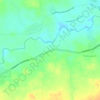
Name: Pudur topographic map, elevation, terrain.

Location: Pudur, Coimbatore South, Coimbatore, Tamil Nadu, India (10.95978 76.80147 10.96273 76.80684)

Average elevation: 1,470 ft

Minimum elevation: 1,421 ft

Maximum elevation: 1,529 ft

Other topographic maps

Click on a map to view its topography, its elevation and its terrain.

Dhaliyur

India > Tamil Nadu > Coimbatore South

Average elevation: 1,621 ft

Semmedu

India > Tamil Nadu > Coimbatore South

Average elevation: 1,503 ft

Ward 65

India > Tamil Nadu > Coimbatore South

Average elevation: 1,316 ft

Solakarai

India > Tamil Nadu > Coimbatore South

Average elevation: 735 ft

Pichanur

India > Tamil Nadu > Coimbatore South

Average elevation: 725 ft

Podanur

India > Tamil Nadu > Coimbatore South

Average elevation: 1,309 ft

Alandurai

India > Tamil Nadu > Coimbatore South > Alandurai

Average elevation: 1,493 ft

Kulathupalayam

India > Tamil Nadu > Coimbatore South

Average elevation: 1,486 ft

Vellalore Lake

India > Tamil Nadu > Coimbatore South > Nanjundapuram

Average elevation: 1,299 ft

Perur

India > Tamil Nadu > Coimbatore South

Average elevation: 1,398 ft

Gear up for your next adventure:

🎒Outdoor Daypacks - Lightweight backpacks designed for carrying maps and essential gear
🧭GPS Watch Accessories - Bands and chargers for GPS watches
🪶Survival Guide Book - Expert advice for emergency preparedness
🪶Paracord Bracelet - Survival bracelet with built‑in tools
🧦Merino Wool Socks - Moisture-wicking, blister-preventing socks for long treks

As an Amazon Associate, this site earns from qualifying purchases at no extra cost to you.