
Elko topographic map
Click on the map to display elevation.
About this map
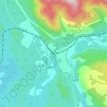
Name: Elko topographic map, elevation, terrain.
Average elevation: 3,333 ft
Minimum elevation: 2,838 ft
Maximum elevation: 5,121 ft
Other topographic maps
Click on a map to view its topography, its elevation and its terrain.
Deer lake
Canada > British Columbia > Regional District of East Kootenay > Area B (Lake Koocanusa)
Average elevation: 2,661 ft
Kikomun Creek Provincial Park
Canada > British Columbia > Regional District of East Kootenay > Area B (Lake Koocanusa) > Baynes Lake
Average elevation: 2,566 ft
Gold Creek
Canada > British Columbia > Regional District of East Kootenay > Area B (Lake Koocanusa)
Average elevation: 2,700 ft