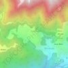
Banni topographic map
Click on the map to display elevation.
About this map

Name: Banni topographic map, elevation, terrain.
Location: Banni, Dharamshala, Kangra, Himachal Pradesh, 176057, India (32.15717 76.35530 32.19717 76.39530)
Average elevation: 3,793 ft
Minimum elevation: 3,087 ft
Maximum elevation: 5,499 ft
Other topographic maps
Click on a map to view its topography, its elevation and its terrain.