Geolocate

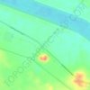
Dendera topographic map

Click on the map to display elevation.

About this map

Name: Dendera topographic map, elevation, terrain.

Location: Dendera, New Valley, Egypt (26.12899 32.61711 26.20899 32.69711)

Average elevation: 256 ft

Minimum elevation: 200 ft

Maximum elevation: 453 ft

Other topographic maps

Click on a map to view its topography, its elevation and its terrain.

Toshka

Egypt > New Valley

Average elevation: 646 ft

Toshka Lakes

Egypt > New Valley

Average elevation: 531 ft

Toshka

Egypt > New Valley

Average elevation: 636 ft

Al Khargah City

Egypt > New Valley

Average elevation: 226 ft

White Desert

Egypt > New Valley

Average elevation: 558 ft

Toshka

Egypt > New Valley

Average elevation: 643 ft

Jouhayna City

Egypt > New Valley

Average elevation: 217 ft

Al Khargah City

Egypt > New Valley

Average elevation: 226 ft

Gear up for your next adventure:

🗺️NatGeo Topo Maps - High-quality waterproof printed topographic maps of US Parks
🏔️Mountain Trail Maps - High‑detail maps for popular peaks
📌Outdoor GPS Map App - Apps and devices for digital topographic navigation
📡Handheld GPS Device - Reliable handheld GPS for outdoor navigation
📻Weather Alert Radios - Stay informed of storm risks while off-the-grid

As an Amazon Associate, this site earns from qualifying purchases at no extra cost to you.