Geolocate

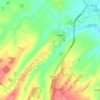
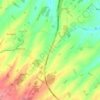
Kingsdown topographic map

Click on the map to display elevation.

About this map

Name: Kingsdown topographic map, elevation, terrain.

Location: Kingsdown, Dover, Kent, England, CT14 8AH, United Kingdom (51.16684 1.38274 51.20684 1.42274)

Average elevation: 66 ft

Minimum elevation: 0 ft

Maximum elevation: 276 ft

Other topographic maps

Click on a map to view its topography, its elevation and its terrain.
Sandwich

United Kingdom > England > Kent > Dover > Stone Cross

Average elevation: 16 ft

Eastry

United Kingdom > England > Kent > Dover > Eastry

Average elevation: 105 ft

Whitfield

United Kingdom > England > Kent > Dover

Average elevation: 331 ft

Temple Ewell

United Kingdom > England > Kent > Dover

Average elevation: 315 ft

Alkham

United Kingdom > England > Kent > Dover

Average elevation: 390 ft

Nonington

United Kingdom > England > Kent > Dover

Average elevation: 223 ft

Tilmanstone

United Kingdom > England > Kent > Dover

Average elevation: 226 ft

Wingham

United Kingdom > England > Kent > Dover

Average elevation: 72 ft

Whitfield

United Kingdom > England > Kent > Dover > Whitfield

Average elevation: 331 ft

River

United Kingdom > England > Kent > Dover

Average elevation: 262 ft

Sandwich

United Kingdom > England > Kent > Dover

Average elevation: 16 ft

Deal

United Kingdom > England > Kent > Dover

Average elevation: 20 ft

River

United Kingdom > England > Kent > Dover > River

Average elevation: 262 ft

Gear up for your next adventure:

🖼️Topo Map Wall Art - Decorative topographic prints of famous peaks and regions
📚Navigation Handbooks - Master the art of reading topographic maps and using a compass
🛏️Cold Weather Sleeping Bag - Warm sleeping bag for cold conditions
🧤Tactile Hiking Gloves - Keep hands warm while operating GPS and smartphone screens
💧Water Filtration Bottles - Safely drink from streams and lakes while exploring

As an Amazon Associate, this site earns from qualifying purchases at no extra cost to you.