
Baldwin topographic map
Click on the map to display elevation.
About this map
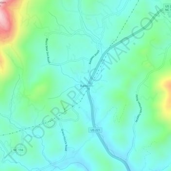
Name: Baldwin topographic map, elevation, terrain.
Location: Baldwin, Ashe County, North Carolina, United States (36.32763 -81.55288 36.36763 -81.51288)
Average elevation: 3,369 ft
Minimum elevation: 2,995 ft
Maximum elevation: 4,757 ft
Ashe County trails, hiking, mountain biking, running and outdoor activities
Other topographic maps
Click on a map to view its topography, its elevation and its terrain.