
Make a donation
Gear up for your next adventure:
As an Amazon Associate, this site earns from qualifying purchases at no extra cost to you.
Weid topographic map
Click on the map to display elevation.
Make a donation
Gear up for your next adventure:
As an Amazon Associate, this site earns from qualifying purchases at no extra cost to you.
About this map
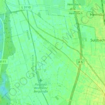
Name: Weid topographic map, elevation, terrain.
Average elevation: 325 ft
Minimum elevation: 302 ft
Maximum elevation: 348 ft
Make a donation
Gear up for your next adventure:
As an Amazon Associate, this site earns from qualifying purchases at no extra cost to you.
Other topographic maps
Click on a map to view its topography, its elevation and its terrain.
Rippenweier
Deutschland > Baden-Württemberg > Rhein-Neckar-Kreis > Weinheim
Average elevation: 1,047 ft
Oberflockenbach
Deutschland > Baden-Württemberg > Rhein-Neckar-Kreis > Weinheim
Average elevation: 1,086 ft
Lützelsachsen
Deutschland > Baden-Württemberg > Rhein-Neckar-Kreis > Weinheim
Average elevation: 627 ft
Hohensachsen
Deutschland > Baden-Württemberg > Rhein-Neckar-Kreis > Weinheim
Hohensachsen liegt an der Bergstraße im Rhein-Neckar-Dreieck und stößt auf den Westrand des Odenwaldes. Der Ort erstreckt sich vom Gebirgsrand und einer Höhe von 97 m NN bis in den kristallinen Odenwald auf 340 m NN. Der hügelige Teil der Ortschaft wird durch einen Bach von Osten nach Westen durchzogen.…
Average elevation: 594 ft
Make a donation
Gear up for your next adventure:
As an Amazon Associate, this site earns from qualifying purchases at no extra cost to you.
Lützelsachsen
Deutschland > Baden-Württemberg > Rhein-Neckar-Kreis > Weinheim
Average elevation: 627 ft