Geolocate

Piedmont topographic map

Click on the map to display elevation.

About this map

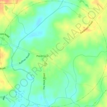
Name: Piedmont topographic map, elevation, terrain.

Location: Piedmont, Lamar County, Georgia, United States (33.00320 -84.26458 33.03219 -84.22958)

Average elevation: 722 ft

Minimum elevation: 663 ft

Maximum elevation: 801 ft

Lamar County trails, hiking, mountain biking, running and outdoor activities

Other topographic maps

Click on a map to view its topography, its elevation and its terrain.

Piedmont

United States > Georgia > Lamar County

Average elevation: 738 ft

Gear up for your next adventure:

🧦Merino Wool Socks - Moisture-wicking, blister-preventing socks for long treks
Backpacking Tent - Lightweight and durable tent for multi‑day hikes
🎒Day Hiking Backpack - Lightweight backpack perfect for day trips and outdoor adventures
👟Trail Running Shoes - Lightweight shoes for trail runners
🧭Pro Hiking Compasses - High-accuracy liquid-filled compasses for topographic orientation

As an Amazon Associate, this site earns from qualifying purchases at no extra cost to you.