Geolocate

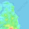
Flynns Beach topographic map

Click on the map to display elevation.

About this map

Name: Flynns Beach topographic map, elevation, terrain.

Location: Flynns Beach, Port Macquarie, Port Macquarie-Hastings Council, New South Wales, 2444, Australia (-31.44475 152.92561 -31.44101 152.92836)

Average elevation: 43 ft

Minimum elevation: 0 ft

Maximum elevation: 200 ft

Other topographic maps

Click on a map to view its topography, its elevation and its terrain.
Taskers

Australia > New South Wales > Port Macquarie

Average elevation: 43 ft

Gear up for your next adventure:

🪶Trail Camera - Capture wildlife on your hikes
🗻Climbing Gear Basics - Essential gear for beginner climbers
🩳Quick‑Dry Hiking Shorts - Comfortable and quick‑dry shorts for summer hiking
📷Action Cameras - Rugged cameras to document your journeys across rugged terrain
🚗GPS Dash Cams - Record your scenic drives through mountain passes and canyons

As an Amazon Associate, this site earns from qualifying purchases at no extra cost to you.