Geolocate

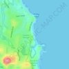
Taskers topographic map

Click on the map to display elevation.

About this map

Name: Taskers topographic map, elevation, terrain.

Location: Taskers, Port Macquarie, Port Macquarie-Hastings Council, New South Wales, 2444, Australia (-31.46555 152.90603 -31.42555 152.94603)

Average elevation: 43 ft

Minimum elevation: -13 ft

Maximum elevation: 354 ft

Other topographic maps

Click on a map to view its topography, its elevation and its terrain.

Gear up for your next adventure:

⛺Backpacking Tents - Weight-optimized shelters for multi-day topographic surveys
🧣Hiking Neck Gaiter - Multi‑use neck protection for outdoor weather
🧭GPS Watch Accessories - Bands and chargers for GPS watches
🌧️Backpack Rain Cover - Keep gear dry in wet weather
👖Convertible Hiking Pants - Versatile zip-off pants for changing altitudes and temperatures

As an Amazon Associate, this site earns from qualifying purchases at no extra cost to you.