
吉多乡 topographic map
Interactive map
Click on the map to display elevation.
About this map
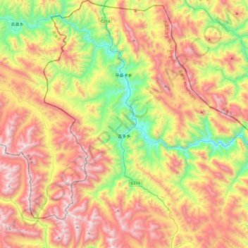
Name: 吉多乡 topographic map, elevation, terrain.
Location: 吉多乡, 类乌齐县, 昌都市, 西藏自治区, 中国 (31.55866 96.17457 31.93263 96.53196)
Average elevation: 14,475 ft
Minimum elevation: 11,739 ft
Maximum elevation: 17,434 ft
Other topographic maps
Click on a map to view its topography, its elevation and its terrain.