
类乌齐镇 topographic map
Interactive map
Click on the map to display elevation.
About this map
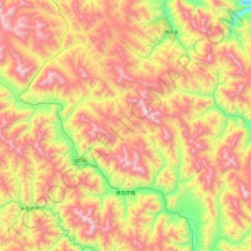
Name: 类乌齐镇 topographic map, elevation, terrain.
Location: 类乌齐镇, 类乌齐县, 昌都市, 西藏自治区, 中国 (31.29750 96.24515 31.61891 96.63322)
Average elevation: 14,613 ft
Minimum elevation: 11,729 ft
Maximum elevation: 17,395 ft
Other topographic maps
Click on a map to view its topography, its elevation and its terrain.