
Crow Lake topographic map
Click on the map to display elevation.
About this map
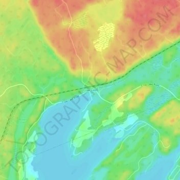
Name: Crow Lake topographic map, elevation, terrain.
Average elevation: 623 ft
Minimum elevation: 531 ft
Maximum elevation: 738 ft
Other topographic maps
Click on a map to view its topography, its elevation and its terrain.
Sharbot Lake
Canada > Ontario > Frontenac County > Central Frontenac > Sharbot Lake
Average elevation: 669 ft
White Lake
Canada > Ontario > Frontenac County > Central Frontenac > Shabot Obaadjiwan First Nation
Average elevation: 741 ft
Eagle Lake
Canada > Ontario > Frontenac County > Central Frontenac > Tichborne
Average elevation: 650 ft