
羌纳乡 topographic map
Interactive map
Click on the map to display elevation.
About this map
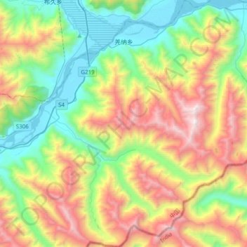
Name: 羌纳乡 topographic map, elevation, terrain.
Location: 羌纳乡, 米林县, 林芝市, 西藏自治区, 中国 (29.20776 94.34981 29.47151 94.62647)
Average elevation: 12,434 ft
Minimum elevation: 9,564 ft
Maximum elevation: 17,388 ft
Other topographic maps
Click on a map to view its topography, its elevation and its terrain.