Geolocate

Laguna topographic map

Click on the map to display elevation.

About this map

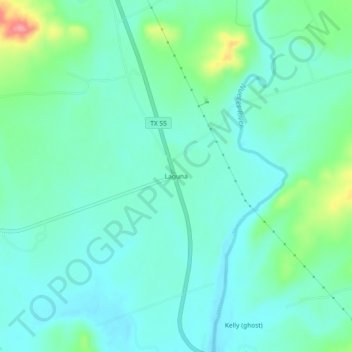
Name: Laguna topographic map, elevation, terrain.

Location: Laguna, Uvalde County, Texas, United States (29.39912 -100.02562 29.43912 -99.98562)

Average elevation: 1,171 ft

Minimum elevation: 1,099 ft

Maximum elevation: 1,414 ft

Uvalde County trails, hiking, mountain biking, running and outdoor activities

Other topographic maps

Click on a map to view its topography, its elevation and its terrain.

Uvalde

United States > Texas > Uvalde County

Average elevation: 919 ft

Onion Creek

United States > Texas > Uvalde County

Average elevation: 1,339 ft

Sabinal

United States > Texas > Uvalde County

Average elevation: 948 ft

Gear up for your next adventure:

🧢Outdoor Hiking Hat - Sun protection hat for outdoor explorers
🥾Women's Hiking Boots - Top-rated trail boots with ankle support and superior grip
🔥Fast-Boil Camping Stoves - Efficient cooking systems for quick trail meals
📷Action Cameras - Rugged cameras to document your journeys across rugged terrain
🛌Ultralight Sleeping Bags - Compact down bags for cold nights in the wilderness

As an Amazon Associate, this site earns from qualifying purchases at no extra cost to you.