
Iturup topographic map
Click on the map to display elevation.
Iturup
The deposits of the Vetrovoy Isthmus include volcanic-tectonic dislocations, pumice pyroclastics, aeolian-ash deposits and soil-tephra formations. The morphometric parameters of the basement terrace indicate an area elevation rate during the last phase of coastal marine accumulation that could reach 4 mm/year, slightly higher than the 3.5 m/year recorded during the last 6000 thousand years.
About this map
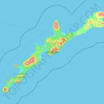
Name: Iturup topographic map, elevation, terrain.
Average elevation: 102 ft
Minimum elevation: 0 ft
Maximum elevation: 5,266 ft