
Seneca topographic map
Click on the map to display elevation.
About this map
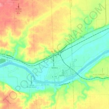
Name: Seneca topographic map, elevation, terrain.
Location: Seneca, LaSalle County, Illinois, United States (41.27854 -88.63794 41.36322 -88.52687)
Average elevation: 591 ft
Minimum elevation: 476 ft
Maximum elevation: 738 ft
LaSalle County trails, hiking, mountain biking, running and outdoor activities
Other topographic maps
Click on a map to view its topography, its elevation and its terrain.
Lower Fox River - Blakes Landing Nature Preserve
United States > Illinois > LaSalle County > Blakes
Average elevation: 597 ft