Geolocate

Overton topographic map

Click on the map to display elevation.

About this map

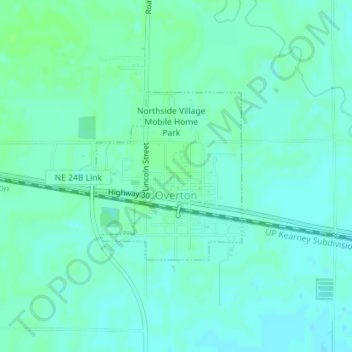
Name: Overton topographic map, elevation, terrain.

Location: Overton, Dawson County, Nebraska, 68863, United States (40.73402 -99.54583 40.74689 -99.53105)

Average elevation: 2,320 ft

Minimum elevation: 2,306 ft

Maximum elevation: 2,333 ft

Dawson County trails, hiking, mountain biking, running and outdoor activities

Other topographic maps

Click on a map to view its topography, its elevation and its terrain.

Lexington

United States > Nebraska > Dawson County > Lexington

Average elevation: 2,470 ft

Gear up for your next adventure:

🧷Carabiner Set - Durable clips for gear attachment
🛰️Handheld GPS Units - Professional satellite navigators for precise backcountry mapping
📡Handheld GPS Device - Reliable handheld GPS for outdoor navigation
🦶Hiking Gaiters - Keep debris and water out of your boots
🎒Gear Packing Cubes - Organize your backpack efficiently

As an Amazon Associate, this site earns from qualifying purchases at no extra cost to you.