Geolocate

Maykop topographic map

Click on the map to display elevation.

About this map

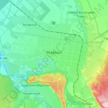
Name: Maykop topographic map, elevation, terrain.

Location: Maykop, городской округ Майкоп, Republic of Adygea, Russia (44.56019 40.03849 44.64948 40.16488)

Average elevation: 764 ft

Minimum elevation: 587 ft

Maximum elevation: 1,306 ft

Gear up for your next adventure:

🛡️Insect Repellent - Protection against bugs during outdoor activities
🧭Pro Hiking Compasses - High-accuracy liquid-filled compasses for topographic orientation
🔦Powerful Headlamps - Ultra-bright hands-free lighting for night navigation
📌Outdoor GPS Map App - Apps and devices for digital topographic navigation
🪶Wildlife Field Guides - Learn animal tracking and species ID

As an Amazon Associate, this site earns from qualifying purchases at no extra cost to you.