Geolocate

Taiba topographic map

Click on the map to display elevation.

About this map

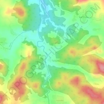
Name: Taiba topographic map, elevation, terrain.

Location: Taiba, Erki(Tamar II), Khunti District, Jharkhand, India (22.89610 85.38403 22.90877 85.40160)

Average elevation: 1,850 ft

Minimum elevation: 1,670 ft

Maximum elevation: 2,057 ft

Other topographic maps

Click on a map to view its topography, its elevation and its terrain.

Koa

India > Jharkhand > Erki(Tamar II)

Average elevation: 1,614 ft

Gear up for your next adventure:

🧭Map Reading Tools - Tools and kits for map navigation
🌲Outdoor Survival Books - Best books on survival skills
GPS Sports Watch - GPS watch for running, hiking and training
🪶Camp Gear Gift Set - Perfect gift bundle for outdoor fans
🧭Hiking Compass - Precision compass for reliable navigation in the wilderness

As an Amazon Associate, this site earns from qualifying purchases at no extra cost to you.