Geolocate

Teutopolis topographic map

Click on the map to display elevation.

About this map

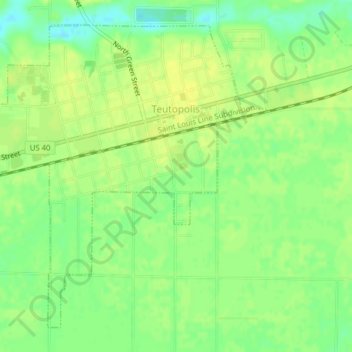
Name: Teutopolis topographic map, elevation, terrain.

Location: Teutopolis, Effingham County, Illinois, 62467, United States (39.11414 -88.50111 39.14038 -88.46188)

Average elevation: 597 ft

Minimum elevation: 558 ft

Maximum elevation: 617 ft

Effingham County trails, hiking, mountain biking, running and outdoor activities

Other topographic maps

Click on a map to view its topography, its elevation and its terrain.

Montrose

United States > Illinois > Effingham County > Montrose

Average elevation: 597 ft

Moccasin

United States > Illinois > Effingham County

Average elevation: 614 ft

Gear up for your next adventure:

🎒Waterproof Dry Bags - Keep your electronics and maps dry inside your pack
🛠️Backpacking Tool Kit - Essential toolkit for outdoor repairs
🎒Trekking Poles - Sturdy poles for balance and stability on rough terrain
🛠️Outdoor Gear Repair Kit - Essential tools to fix gear on the trail
🌡️Portable Weather Meter - Track weather conditions on the trail

As an Amazon Associate, this site earns from qualifying purchases at no extra cost to you.