Geolocate

Al Minya topographic map

Click on the map to display elevation.

About this map

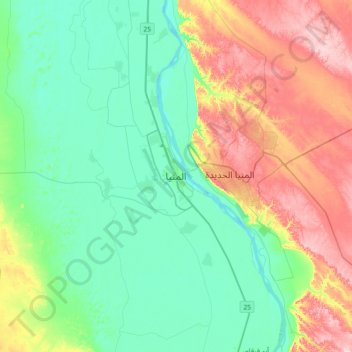
Name: Al Minya topographic map, elevation, terrain.

Location: Al Minya, 61511, Egypt (27.92933 30.59706 28.24933 30.91706)

Average elevation: 272 ft

Minimum elevation: 82 ft

Maximum elevation: 679 ft

Other topographic maps

Click on a map to view its topography, its elevation and its terrain.

Smalout City

Egypt > Al Minya

Average elevation: 125 ft

New Al Minya

Egypt > Al Minya

Average elevation: 364 ft

Sayed Galal

Egypt > Al Minya > Sayed Galal

Average elevation: 135 ft

Gear up for your next adventure:

🦟Ultrasonic Repellers - Create a bug-free zone at your camp or rest stop
🪶Trail Camera - Capture wildlife on your hikes
🏕️Family Camping Gear - Essentials for group camping trips
🥾Women's Hiking Boots - Top-rated trail boots with ankle support and superior grip
🎒Trail Energy Bars - High‑calorie bars for hiking energy

As an Amazon Associate, this site earns from qualifying purchases at no extra cost to you.