Geolocate

Lilly Lake topographic map

Click on the map to display elevation.

About this map

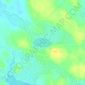
Name: Lilly Lake topographic map, elevation, terrain.

Location: Lilly Lake, Newton Township, Mackinac County, Michigan, United States (46.12904 -85.79568 46.13204 -85.78716)

Average elevation: 738 ft

Minimum elevation: 705 ft

Maximum elevation: 787 ft

Other topographic maps

Click on a map to view its topography, its elevation and its terrain.

Mackinac Island

United States > Michigan > Mackinac County

Average elevation: 600 ft

Saint Ignace

United States > Michigan > Mackinac County

Average elevation: 620 ft

Castle Rock

United States > Michigan > Mackinac County

Average elevation: 607 ft

Saint Ignace

United States > Michigan > Mackinac County

Average elevation: 620 ft

Moran Township

United States > Michigan > Mackinac County

Average elevation: 669 ft

Mackinac Island

United States > Michigan > Mackinac County

Average elevation: 600 ft

Clark Township

United States > Michigan > Mackinac County

Average elevation: 640 ft

Mitten Lake

United States > Michigan > Mackinac County

Average elevation: 732 ft

Gear up for your next adventure:

🧭Compass with Lanyard - Easy‑carry compass for navigation
Backpacking Tent - Lightweight and durable tent for multi‑day hikes
🧣Hiking Neck Gaiter - Multi‑use neck protection for outdoor weather
🎒Outdoor Daypacks - Lightweight backpacks designed for carrying maps and essential gear
🥾Women's Hiking Boots - Top-rated trail boots with ankle support and superior grip

As an Amazon Associate, this site earns from qualifying purchases at no extra cost to you.