
Mackinac Island topographic map
Click on the map to display elevation.
About this map
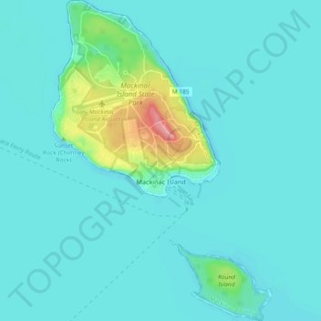
Name: Mackinac Island topographic map, elevation, terrain.
Average elevation: 600 ft
Minimum elevation: 554 ft
Maximum elevation: 883 ft
Mackinac County trails, hiking, mountain biking, running and outdoor activities
Other topographic maps
Click on a map to view its topography, its elevation and its terrain.
Caffey Corner
United States > Michigan > Mackinac County > Hendricks Township
Average elevation: 860 ft
Crossville Lake
United States > Michigan > Mackinac County > Hendricks Township
Average elevation: 863 ft