Geolocate

Avonport topographic map

Click on the map to display elevation.

About this map

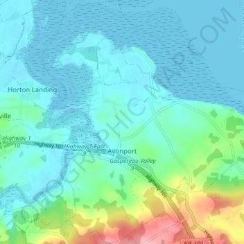
Name: Avonport topographic map, elevation, terrain.

Location: Avonport, Municipality of the County of Kings, Kings County, Nova Scotia, B0P 1B0, Canada (45.08155 -64.27898 45.13035 -64.21022)

Average elevation: 85 ft

Minimum elevation: -20 ft

Maximum elevation: 449 ft

Other topographic maps

Click on a map to view its topography, its elevation and its terrain.

Gear up for your next adventure:

📷Action Camera - Capture your outdoor adventures in HD
🔪Outdoor Multitools - Essential survival tools for gear repair and field use
🛏️Cold Weather Sleeping Bag - Warm sleeping bag for cold conditions
⛑️Personal Locator Beacon - Safety beacon for emergencies
🦶Carbon Trekking Poles - Reduce knee impact on steep descents with ultra-light poles

As an Amazon Associate, this site earns from qualifying purchases at no extra cost to you.