
Gillingham topographic map
Click on the map to display elevation.
About this map
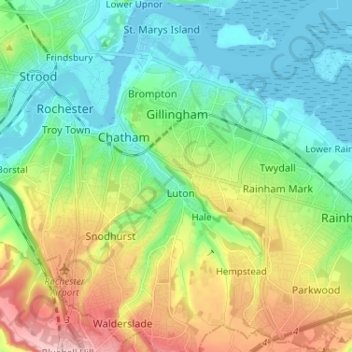
Name: Gillingham topographic map, elevation, terrain.
Location: Gillingham, Medway, England, United Kingdom (51.33253 0.52684 51.41326 0.64678)
Average elevation: 194 ft
Minimum elevation: -7 ft
Maximum elevation: 610 ft
Other topographic maps
Click on a map to view its topography, its elevation and its terrain.
Rainham Creek
United Kingdom > England > Medway > Gillingham > Lower Rainham > Motney Hill
Average elevation: 13 ft