Geolocate

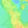
Archbold topographic map

Click on the map to display elevation.

About this map

Name: Archbold topographic map, elevation, terrain.

Location: Archbold, Highlands County, Florida, United States (27.16144 -81.37202 27.20144 -81.33202)

Average elevation: 151 ft

Minimum elevation: 118 ft

Maximum elevation: 217 ft

Highlands County trails, hiking, mountain biking, running and outdoor activities

Other topographic maps

Click on a map to view its topography, its elevation and its terrain.

Sebring

United States > Florida > Highlands County

Average elevation: 112 ft

Lake Placid

United States > Florida > Highlands County

Lake Placid, located in Highlands County, Florida, is situated on relatively flat terrain characteristic of the Florida Peninsula. The town's average elevation is approximately 150 feet (46 meters) above sea level, with elevations ranging from a minimum of about 69 feet (21 meters) to a maximum of about 165…

Average elevation: 105 ft
Lake Huntley

United States > Florida > Highlands County

Average elevation: 98 ft

Placid Lakes

United States > Florida > Highlands County

Average elevation: 108 ft

Avon Park

United States > Florida > Highlands County

Average elevation: 141 ft

Avon Park

United States > Florida > Highlands County

Average elevation: 141 ft

Sebring

United States > Florida > Highlands County

Average elevation: 112 ft

Lake Placid

United States > Florida > Highlands County

Average elevation: 105 ft

Gear up for your next adventure:

📦Dry Bags Set - Waterproof storage for electronics and clothes
🔥Camping Stove - Portable stove for camping and backcountry cooking
🏔️Mountain Trail Maps - High‑detail maps for popular peaks
🕶️GPS Smartphone Mount - Secure mount for phone navigation
🪑Ultralight Camp Chairs - Portable seating for resting after a long day of mapping

As an Amazon Associate, this site earns from qualifying purchases at no extra cost to you.