
Make a donation
Gear up for your next adventure:
As an Amazon Associate, this site earns from qualifying purchases at no extra cost to you.
Placid Lakes topographic map
Click on the map to display elevation.
Make a donation
Gear up for your next adventure:
As an Amazon Associate, this site earns from qualifying purchases at no extra cost to you.
About this map
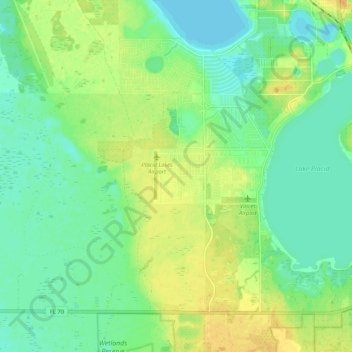
Name: Placid Lakes topographic map, elevation, terrain.
Location: Placid Lakes, Highlands County, Florida, United States (27.20852 -81.45264 27.28178 -81.34697)
Average elevation: 108 ft
Minimum elevation: 69 ft
Maximum elevation: 157 ft
Highlands County trails, hiking, mountain biking, running and outdoor activities
Make a donation
Gear up for your next adventure:
As an Amazon Associate, this site earns from qualifying purchases at no extra cost to you.
Other topographic maps
Click on a map to view its topography, its elevation and its terrain.
Lake Placid
United States > Florida > Highlands County
Lake Placid, located in Highlands County, Florida, is situated on relatively flat terrain characteristic of the Florida Peninsula. The town's average elevation is approximately 150 feet (46 meters) above sea level, with elevations ranging from a minimum of about 69 feet (21 meters) to a maximum of about 165…
Average elevation: 105 ft
Make a donation
Gear up for your next adventure:
As an Amazon Associate, this site earns from qualifying purchases at no extra cost to you.
Make a donation
Gear up for your next adventure:
As an Amazon Associate, this site earns from qualifying purchases at no extra cost to you.