Geolocate

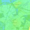
Bad Schönborn topographic map

Click on the map to display elevation.

About this map

Name: Bad Schönborn topographic map, elevation, terrain.

Location: Bad Schönborn, VVG der Gemeinde Bad Schönborn, Landkreis Karlsruhe, Baden-Württemberg, 76669, Germany (49.18947 8.57346 49.24343 8.69149)

Average elevation: 440 ft

Minimum elevation: 322 ft

Maximum elevation: 804 ft

Other topographic maps

Click on a map to view its topography, its elevation and its terrain.
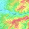
Zeutern

Germany > Baden-Württemberg > Landkreis Karlsruhe

Average elevation: 558 ft

Gear up for your next adventure:

🎒Gear Packing Cubes - Organize your backpack efficiently
🧭Map Reading Tools - Tools and kits for map navigation
🧷Carabiner Set - Durable clips for gear attachment
🧭Compass with Lanyard - Easy‑carry compass for navigation
🪶Wildlife Field Guides - Learn animal tracking and species ID

As an Amazon Associate, this site earns from qualifying purchases at no extra cost to you.