Geolocate

Waskemeer topographic map

Click on the map to display elevation.

About this map
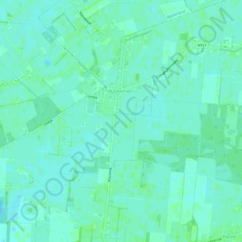
Name: Waskemeer topographic map, elevation, terrain.

Location: Waskemeer, Ooststellingwerf, Frisia, Netherlands (53.03583 6.25111 53.06941 6.30541)

Average elevation: 23 ft

Minimum elevation: 10 ft

Maximum elevation: 33 ft

Other topographic maps

Click on a map to view its topography, its elevation and its terrain.
Leeuwarden

Netherlands > Frisia > Leeuwarden

Average elevation: 0 ft

Vierhuizen

Netherlands > Frisia > Allingawier

Average elevation: -7 ft

Oost-Vlieland

Netherlands > Frisia

Average elevation: 7 ft

Kooiplaats

Netherlands > Frisia > Buren

Average elevation: 3 ft

Loënga

Netherlands > Frisia > Loënga

Average elevation: 0 ft

Gear up for your next adventure:

🪶Thermal Camp Blanket - Extra warmth for cold nights
🛰️Handheld GPS Units - Professional satellite navigators for precise backcountry mapping
🔥Plasma Lighters - Windproof lighters that work in any weather condition
🖼️Topo Map Wall Art - Decorative topographic prints of famous peaks and regions
🔥Camping Stove - Portable stove for camping and backcountry cooking

As an Amazon Associate, this site earns from qualifying purchases at no extra cost to you.