Geolocate

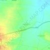
Alang topographic map

Click on the map to display elevation.

About this map

Name: Alang topographic map, elevation, terrain.

Location: Alang, Akola, Ahilyanagar District, Maharashtra, India (19.58191 73.66093 19.58201 73.66103)

Average elevation: 3,474 ft

Minimum elevation: 2,546 ft

Maximum elevation: 4,895 ft

Other topographic maps

Click on a map to view its topography, its elevation and its terrain.

Nizampur

India > Maharashtra > Akola

Average elevation: 919 ft

Hingna Barling

India > Maharashtra > Akola

Average elevation: 938 ft

Kothari

India > Maharashtra > Akola

Average elevation: 981 ft

Nawakheda

India > Maharashtra > Akola

Average elevation: 886 ft

Pahadpur

India > Maharashtra > Akola

Average elevation: 981 ft

Dongargaon

India > Maharashtra > Akola > Dongargaon

Average elevation: 965 ft

Babhulgaon

India > Maharashtra > Akola > Babhulgaon

Average elevation: 965 ft

Borgaon Manju

India > Maharashtra > Akola

Average elevation: 968 ft

Umerkhed

India > Maharashtra > Akola

Average elevation: 932 ft

Gear up for your next adventure:

📦Gear Storage Bags - Organize and protect outdoor equipment
📱Heavy-Duty Phone Cases - Drop-proof and waterproof protection for outdoor navigation
🪶Multi‑Purpose Knife - Useful blade for camp and trail
🗻Climbing Gear Basics - Essential gear for beginner climbers
🥾Women's Hiking Boots - Top-rated trail boots with ankle support and superior grip

As an Amazon Associate, this site earns from qualifying purchases at no extra cost to you.