Geolocate

Izhevsk topographic map

Click on the map to display elevation.

About this map
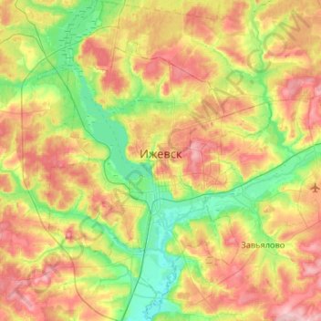
Name: Izhevsk topographic map, elevation, terrain.

Location: Izhevsk, Udmurtia, Volga Federal District, Russia (56.71641 53.00656 57.00476 53.39138)

Average elevation: 459 ft

Minimum elevation: 276 ft

Maximum elevation: 712 ft

Other topographic maps

Click on a map to view its topography, its elevation and its terrain.

Кеп

Russia > Udmurtia > Balezinsky District

Average elevation: 509 ft

Банное

Russia > Udmurtia > Zavyalovsky District

Average elevation: 492 ft

Gear up for your next adventure:

🥤Water Filter Bottle - All‑in‑one filter bottle for safe hydration
🚪Portable Camp Chair - Foldable chair for comfort at camp
🪓Survival Multi‑Tool - Versatile tool for camp and trail tasks
🚗GPS Dash Cams - Record your scenic drives through mountain passes and canyons
🏕️Family Camping Gear - Essentials for group camping trips

As an Amazon Associate, this site earns from qualifying purchases at no extra cost to you.