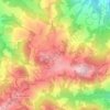
Montese topographic map
Click on the map to display elevation.
Montese
Montese is associated with traditional mountain products and dishes. The Patata di Montese is listed by the Emilia-Romagna Region among the region's traditional agri-food products. It is produced in parts of Montese, Zocca, Gaggio Montano, Castel d'Aiano and the Querciola area of Lizzano in Belvedere, at a minimum altitude of 600 metres above sea level. Its traditional cultivars are late and medium-late varieties, with light yellow or white flesh and yellow or reddish-brown skin; early varieties are excluded by the production rules.
About this map
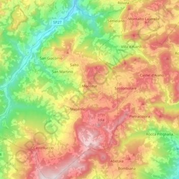
Name: Montese topographic map, elevation, terrain.
Location: Montese, Modena, Emilia-Romagna, 41055, Italy (44.20639 10.86052 44.32602 11.00659)
Average elevation: 2,146 ft
Minimum elevation: 791 ft
Maximum elevation: 3,661 ft
Other topographic maps
Click on a map to view its topography, its elevation and its terrain.
Monte Cimone
Italy > Emilia-Romagna > Modena > Fiumalbo
The mountain has an elevation of 2,165 m and is also the highest point in the Emilia-Romagna region of Italy.
Average elevation: 5,771 ft