
Oryol topographic map
Click on the map to display elevation.
About this map
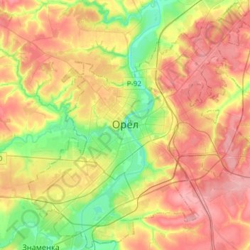
Name: Oryol topographic map, elevation, terrain.
Location: Oryol, Oryol Oblast, Central Federal District, Russia (52.89550 35.97402 53.04058 36.21904)
Average elevation: 636 ft
Minimum elevation: 469 ft
Maximum elevation: 797 ft
Other topographic maps
Click on a map to view its topography, its elevation and its terrain.