Geolocate

Mulberry topographic map

Click on the map to display elevation.

About this map

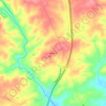
Name: Mulberry topographic map, elevation, terrain.

Location: Mulberry, Surry County, North Carolina, United States (36.30708 -80.82285 36.34708 -80.78285)

Average elevation: 1,119 ft

Minimum elevation: 932 ft

Maximum elevation: 1,257 ft

Surry County trails, hiking, mountain biking, running and outdoor activities

Other topographic maps

Click on a map to view its topography, its elevation and its terrain.

Flat Rock

United States > North Carolina > Surry County

Average elevation: 1,093 ft

Gear up for your next adventure:

🛡️Bear Spray Outdoor - Protection in bear country hikes
🚑Emergency Bivvies - Heat-reflective sleeping bags for survival situations
🪶Camp Gear Gift Set - Perfect gift bundle for outdoor fans
🖼️Topo Map Wall Art - Decorative topographic prints of famous peaks and regions
📦Dry Bags Set - Waterproof storage for electronics and clothes

As an Amazon Associate, this site earns from qualifying purchases at no extra cost to you.