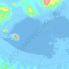
Qattara Depression topographic map
Click on the map to display elevation.
Qattara Depression
The Qattara Depression contains the second lowest point in Africa at an elevation of 133 metres (436 ft) below sea level, the lowest point being Lake Assal in Djibouti. The depression covers about 19,605 square kilometres (7,570 sq mi), a size comparable with Lake Ontario or twice as large as Lebanon. Due to its size and proximity to the shores of the Mediterranean Sea, studies have been made proposing to flood the area for various usages, such as the potential to generate hydroelectricity there.
About this map

Name: Qattara Depression topographic map, elevation, terrain.
Location: Qattara Depression, Matruh, Egypt (29.99000 27.49000 30.01000 27.51000)
Average elevation: -246 ft
Minimum elevation: -256 ft
Maximum elevation: -236 ft
Other topographic maps
Click on a map to view its topography, its elevation and its terrain.