
Neosho topographic map
Click on the map to display elevation.
About this map
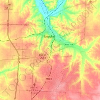
Name: Neosho topographic map, elevation, terrain.
Location: Neosho, Newton County, Missouri, United States (36.79178 -94.44777 36.90942 -94.33391)
Average elevation: 1,178 ft
Minimum elevation: 971 ft
Maximum elevation: 1,306 ft
Newton County trails, hiking, mountain biking, running and outdoor activities
Other topographic maps
Click on a map to view its topography, its elevation and its terrain.