Geolocate

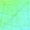
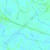
Conselve topographic map

Click on the map to display elevation.

About this map

Name: Conselve topographic map, elevation, terrain.

Location: Conselve, Padova, Veneto, Italia (45.20082 11.83739 45.25665 11.93025)

Average elevation: 13 ft

Minimum elevation: -3 ft

Maximum elevation: 30 ft

Other topographic maps

Click on a map to view its topography, its elevation and its terrain.
Monte Venda

Italia > Veneto > Padova > Vo'

Average elevation: 984 ft

Perarolo

Italia > Veneto > Padova > Vigonza

Average elevation: 30 ft

Campolongo

Italia > Veneto > Padova > Vo'

Average elevation: 397 ft

Santa Maria di Non

Italia > Veneto > Padova

Average elevation: 66 ft

Rustega

Italia > Veneto > Padova > Camposampiero

Average elevation: 69 ft

Monte Rusta

Italia > Veneto > Padova > Faedo

Average elevation: 433 ft

Villa

Italia > Veneto > Padova

Average elevation: 400 ft

Onara

Italia > Veneto > Padova

Average elevation: 125 ft

Caselle

Italia > Veneto > Padova > Selvazzano Dentro

Average elevation: 49 ft

Ca' Molin

Italia > Veneto > Padova > Bovolenta

Average elevation: 7 ft

Gear up for your next adventure:

📷Action Camera - Capture your outdoor adventures in HD
🪶Survival Guide Book - Expert advice for emergency preparedness
📶Satellite Messenger - Communication device off‑grid
🎁Geography Themed Gifts - Unique gift ideas for map lovers and geography enthusiasts
🛠️Outdoor Gear Repair Kit - Essential tools to fix gear on the trail

As an Amazon Associate, this site earns from qualifying purchases at no extra cost to you.